Enabling MrSID image support
The OpenGeo Suite comes with support for publishing data from many formats supported by the Geospatial Data Abstraction Library (GDAL). These formats include DTED, EHdr, AIG, ENVIHdr, and much more.
MrSID is available as an optional extension as well, but due to licensing issues, it is not enabled by default. The steps to enable support will differ depending on how the OpenGeo Suite is installed, and on what platform.
Find the method of installation below and continue there.
Ubuntu
Note
By default, OpenGeo Suite for Applications Servers (WAR bundle) will not show any of the GDAL image formats at all. To enable GDAL image formats in this type of installation, please see the section on Enabling GDAL image formats support. This section assumes that the GDAL image formats are already enabled.
MrSID support is provided by a separate package called gdal-mrsid.
Install the following package from the OpenGeo repository. (See Installation on Ubuntu Linux for instructions on how to add the OpenGeo repository):
# apt-get install gdal-mrsidNote
You must run these commands as root or use sudo.
Restart Tomcat.
Continue at the Verifying installation section.
CentOS / Red Hat
Note
By default, the OpenGeo Suite for Application Servers will not show any of the GDAL image formats at all. To enable GDAL image formats in this type of install, please see the section on Enabling GDAL image formats support. This section assumes that the GDAL image formats are already enabled.
MrSID support is provided by a separate package called gdal-mrsid.
Install the following package from the OpenGeo repository. (See New installation on Red Hat Linux for instructions on how to add the OpenGeo repository):
# yum install gdal-mrsidNote
You must run this command as root or use sudo.
Copy /usr/lib/gdal.jar (/usr/lib64/gdal.jar on 64-bit installs) to /usr/share/tomcat6/webapps/geoserver/WEB-INF/lib/gdal-1.8.1.jar.
Note
You may need to replace tomcat6 with tomcat5 in the above path depending on the server configuration.
Restart Tomcat.
Continue reading at the Verifying installation section.
Windows
Windows Installer
MrSID support must be enabled during the installation process.
Navigate through the installer until you reach the Choose Components page.
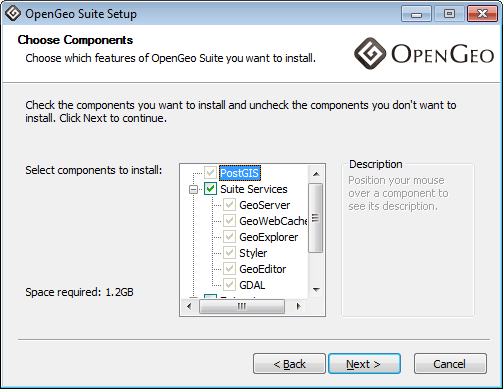
The Components page of the Windows installer
Scroll down to the Extensions option, and expand the tree. Check the box for MrSID.
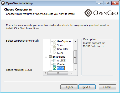
Enabling the MrSID extension
Click Next and continue the installation process.
Continue reading at the Verifying installation section.
Windows Application Servers
Navigate to: http://data.opengeo.org/gdal_support/ .
Download the file that matches the version of the OpenGeo Suite (e.g. mrsid_win_30.zip for version 3.0).
Note
This file requires 32-bit Java/Tomcat.
Extract the contents of this archive to the location where the GDAL libraries were extracted (see Enabling GDAL image formats support).
Restart Tomcat.
Continue reading at the Verifying installation section.
Mac OS X
Mac OS X Installer
MrSID support is enabled via a separate installation package, available in the OpenGeo Suite bundle. In addition to the standard OpenGeo Suite Installer.pkg file, there is also an OpenGeo Suite Extensions.mpkg file.
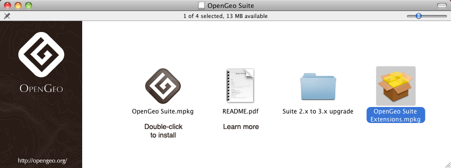
OpenGeo Suite Extensions contain MrSID support
Double click on this file to install MrSID after the OpenGeo Suite installation process has completed. Click Next to continue.
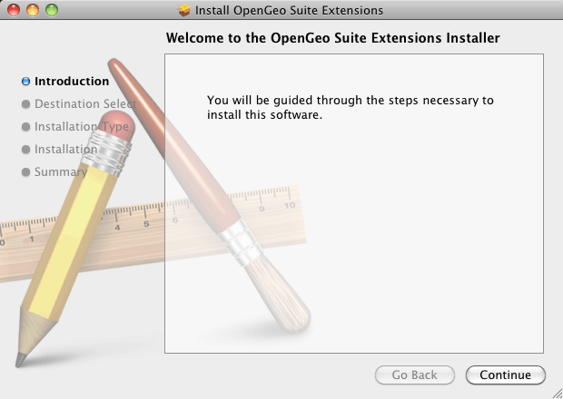
OpenGeo Suite Extensions contain the MrSID extension
Select the target disk, which should be the same as where the OpenGeo Suite was installed. Click Next again.
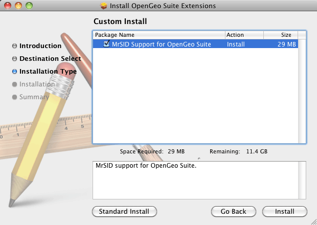
On the following page, check the box that says MrSID Support for OpenGeo Suite, then click Next.
Check this box to install MrSID support
Please wait while the installation proceeds.
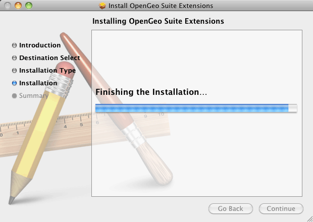
Installation
You will receive confirmation that the installation was successful.
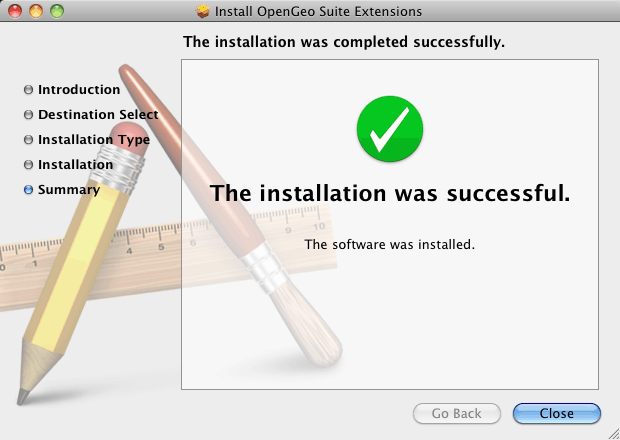
MrSID support successfully installed
Continue reading at the Verifying installation section.
Mac OS X Application Servers
- Navigate to: http://data.opengeo.org/gdal_support/
- Download the file that matches the version of the OpenGeo Suite (e.g. mrsid_osx_30.zip for version 3.0).
- Extract the contents of the archive into /usr/local/lib/.
- Restart Tomcat.
Continue reading at the Verifying installation section.
Verifying installation
To verify that the MrSID extension was installed properly, navigate to the GeoServer web admin interface and log in with administrator credentials.
Note
Please see the GeoServer reference documentation for more information about the GeoServer web admin interface.
Click on Stores and then Add new Store. There should be a MrSID option under Raster Data Formats.
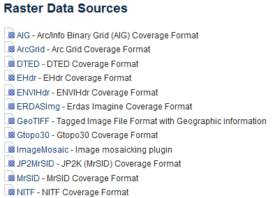
Verifying that MrSID is an option in the Raster Data Sources